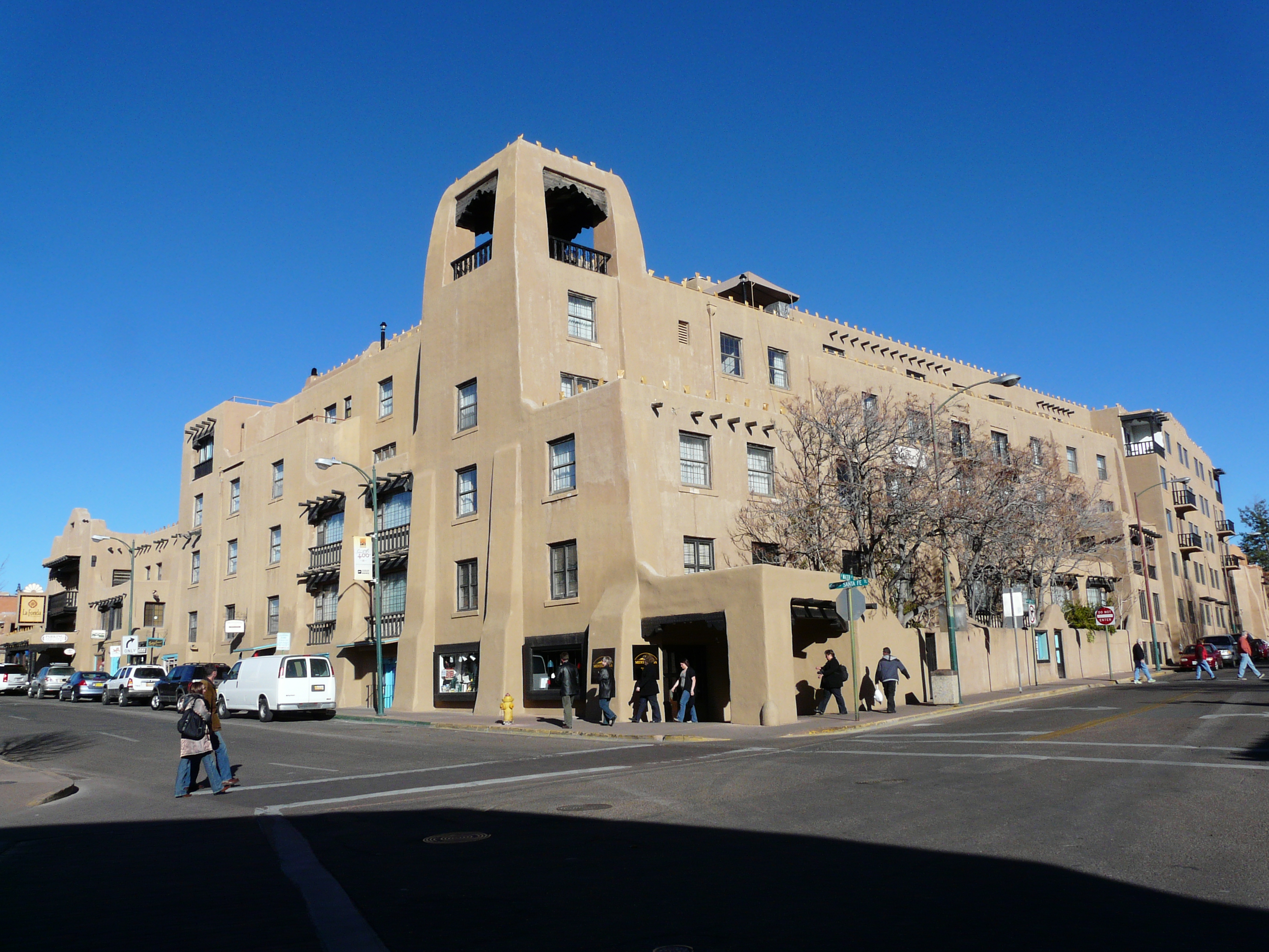
Category Archives: News

Malta

I was finally able to get away for a holiday this year to the tiny Mediterranean island chain of Malta. It was short for a European holiday, only six days, but well worth it. Malta is a popular European tourist destination internationally, and you will find travelers there from all over the world.

Hotels: Planning a visit, requires a little thought. Malta is really three tiny islands, including Gozo, Comino and Malta itself. Most travelers will opt to book a hotel in Malta, but Gozo also offers some nice options. I booked a Holiday Inn, and it was a great experience, but you needn’t restrict yourself to chain hotels: Malta has many good locally owned hotels. Location does matter especially if you are relying on public transit. On the map, the capitol of Valetta is the centre of a broad metropolis of suburbs, and it is also the central tourist hub, so proximity does matter. In my case, I booked in the party district of St Julians, called Paceville. Initially I thought I had made a mistake, but as it turned out, it could not have worked out much better. In addition to offering numerous restaurant options, it was close to public transit, and even offered a nearby stop on the Hop on Hop off bus route. That being said, there are also numerous hotel options in other regions such as Sliema, Florianna Gzira and even Valetta itself that would do just as well.

Flights: There are no direct flights from North America,, so you have to book a transatlantic, plus a local flight to get there. Fortunately, Air Malta serves numerous European airports, so finding a good combination is not difficult. It is a long flight. Total travel time with the connection was about 13 hours from Toronto, which was the shortest trip I could find, although actual airtime was about 9 hours. I found Air Malta a good flight experience, and recommend it to anyone. Once you arrive at Luqa International, pick up your bags, and take a quick cab ride to your hotel, and you are there.

Public Transit, Tours and Foot Power: The Malta bus line is inexpensive and has good coverage across the island. Its routes are linked to Google Maps so you can easily find nearby stops and route information on your phone. In Malta, all bus routes lead to Valetta, so wherever you plan to go, factor in stopping at the central bus terminal in front of the Valetta gates as part of the itinerary. Since most Malta holidays will include a stop or two in Valetta itself, this is hardly an inconvenience. Be patient, the streets twist like a corkscrew through the hills and bays of the greater Valetta area, so no matter what mode of transport you choose, you are not going anywhere in a hurry. I also made use of some tours that were booked through my hotel, as well as the two days of Hop on Hop off tour. There are numerous tour options, so depending on your tastes, read through the brochures carefully taking note of which days the tours depart. I used Malta Supreme tours for a night tour through central Malta, which was okay, but the day trip to nearby Gozo was excellent. No trip to Malta is complete without a harbor cruise. I did two of these, and it was well worth it. I used Malta Sightseeing’s Hop on Hop off tour, and was pleasantly surprised.

Getting Around (Part 2)

Getting around in major cities

When visiting a city, determining how you get around can be daunting at first because you have a long list of things to do, and not that much time to do it.. It’s unlikely you will rely on only one method of transport, but which is best?

Many people like to walk, and there is no doubt that this is the most intimate way to experience a city – up close and without barriers. However to rely on foot power alone can wear you out quickly if you are not in great shape, and can limit the amount you can see on your holiday. Look at your destination’s geographic layout, and ask yourself how much can I do on foot, and when should I leave the driving to someone else? Be realistic, factor in how much abuse your feet can take in one day, and equally important, how much more time is it going to take compared to using a conveyance? There are places where walking is definitely the best way. The great Italian cities of Rome, Florence or Venice can be easily navigated on foot, and what better way to experience their charms. All three have public transit, or other means, to get around, but it is not absolutely essential unless you have mobility issues. Try to strike a balance, if possible, between your to do list and your energy level. You can blitz Paris or London in a day or two by efficient use of its subway, but you would be missing out on the city’s shops, cafes and visual ambiance. Relax, it’s a holiday. It’s not about how many selfies you can take in front of major monuments in one day.  

Public transit offers a fast and convenient way to plot out your day, but it does require you to acquaint yourself with the route system and frequency to determine your most time efficient and user friendly route. Grouping your day’s stops by focusing on an area is never a bad idea, even if you have to include lower priority sites to fill out your day plan. Finally, have a look at how close your destination is to the subway exit, or bus stop. Even using Google Maps, distances can be deceiving, and what seems like a short walk may use up more time and energy than expected. For example, cities like London or Paris may be best appreciated on foot, but are larger than they appear initially, and are best navigated using their first-class subway systems. If cost is a concern, investigate the transit system fare options. Invariably, there is some tourist friendly option that will save you both time and money. This can come in the form of multi-day transit passes such as the Paris Visite, New York MetroPass, or with the Berlin Welcome Card. Another approach are re-loadable cash cards such as London’s Oyster Card, Toronto’s Presto, Boston’s Charlie Card or Tokyo’s Suica or Passmo. It is debatable as to which is more cost effective, so check into it before committing. Whatever you do, avoid buying individual fares, unless there is no other way.

If you prefer a taxi you will get the benefit of direct point to point transit, which is certainly convenient, however, it’s not always efficient. Before committing, consider the distance and traffic on route to your destination. Anyone who’s witnessed the traffic snarls in downtown London can attest to the notion that it is often faster to walk, and definitely faster to take the subway. Paris is not as problematic for driving, but its subway system stops are arranged so close to it’s major tourist sites it makes no sense to us taxis. At the other extreme, great expanses of urban sprawl like Los Angeles are definitively not walk-able, and not as easy to get around in by public transit, despite a steadily improving transit system. You can do an LA holiday via public transit, but this is one city where you’re likely better off to take a cab. If budget is a concern, you have to weigh convenience versus cost. In general, taxis are by far the most expensive option by comparison to public transit, but may only provide a marginal time saving advantage. However, if time is short

So when is it a good idea to use tours? Actually, just about any time.  Tours in most major tourist centres can encompass everything from neighborhood walking tours to fully escorted excursions, often including meals. Budget and time will dictate just exactly how much of it you wish to do, but it is worth investigating all the available options. I’ve made frequent use of the hop on hop off bus tours offered in almost all major cities. It essentially combines the benefit of public transit, but with guided commentary (usually recorded audio in multiple languages) focused around only the most popular tourist sites. Though much more expensive than public transit, Hop on Hop off is especially convenient if you are short of time and want to cover a lot of ground. I have also found them especially good for overseas trips where you may be suffering jet lag on the first day or two. Hop on, enjoy the view from relative comfort, and get off only when you want to, or just stay on depending on how you feel. Though hop on hop off services are quite similar, the quality of service can vary a lot from one place the next. In North America, you can expect to see either the double-decker open top variety, or the smaller trolley bus. From a tourist perspective the only real difference is that the open top version offers a better view. If you’re taking pictures, you can do pretty well either way provided that the windows are down, the weather is nice and you’re quick on the draw. In Europe, you tend to see more of the open top double-decker and fewer trolleys, but may also encounter everything from miniature trains to motor coaches. One tip for the avid photographer: Scope out the route in advance to determine which side of the bus to sit on. If in doubt, try to sit on the left side since this will give you a wider, better view than if you sat on the right side, which leaves little distance between you and the sidewalk. This rule applies on to cities where people drive on the right side of the road. In the UK or Japan, you would probably want to reverse the position.

I’ve made frequent use of the hop on hop off bus tours offered in many major cities. It essentially combines the benefit of public transit, but with guided commentary (usually recorded audio), and aimed at only the tourist sites you have come to see. Though much more expensive than public transit, Hop on Hop off is especially convenient if you are short of time and want to cover a lot of ground. I have also found them especially good for overseas trips where you may be suffering jet lag on the first day or two. Hop on, enjoy the view from relative comfort, and get off only when you want to, or just stay on depending on how you feel. Though hop on hop off services are quite similar, the quality of service can vary a lot from one place the next. As a low vision traveler, there are few things you need to keep in mind with them however. In North America, you can expect to see either the double-decker open top variety, or the smaller trolley bus. From a tourist perspective the only real difference is that the open top version offers a better view. If you’re taking pictures, you can do pretty well either way provided that the windows are down, the weather is nice and you’re quick on the draw. In Europe, you tend to see more of the open top double-decker and fewer trollies, but may also encounter everything from miniature trains to motor coaches that perform the same function.

The cost of transportation can vary greatly from place to place, and it is worthwhile to examine all options to determine your most cost efficient option. Walking may be free, but if you investigate you may find that public transit can be purchased at a very reasonable cost. Visiting the city transit site is well worth it. Not only do you gain invaluable detail about your destination, you can look up the available fare options to see what best suits your budget, or what is most convenient. For example, nearly every city offers multi-day passes that offer a convenient way to use transit without having the hassle of purchasing individual tickets. Paris and New York City Transit system offer this this type of pass. Frequently, Tourist information centres and related attractions sell omnibus travel passes such as City Pass that include free public transit as well as discounted, free or express admission to many sites. I have used this in here in Toronto, and San Francisco where you can ride the cable car at will for up to 7 days. Often there are multiple competing passes in major destinations so it is worth it to shop around. New York Pass and London Pass both worked well for me in terms of transit coverage.  Conversely, many cities have re-loadable cash cards that allow you to transit the city with peace of mind. London offers the Oyster Card. In Toronto, its called Presto, while in Boston, its called the Charlie Card. 

Not every part of your holiday may be within the city limits. In a future blog, I will look at the benefits of day trips and excursions. 

Getting Around (Part 1)

Arrival

One of the biggest travel challenges for the vision impaired is transportation. The challenge can be at virtually every point in the course of a vacation; from the point of arrival at the airport, to getting to your hotel, or to just finding a good place to eat. For this reason, research and preparation is essential to avoid problems, and enjoy your trip as opposed to making it a test to see how much stress you can absorb. While there is no 100% solution that it’s going to remove all barriers, you can significantly reduce the likelihood of a problem by putting some time into getting to know your destination.

To begin with, I’m not thinking about vacations to all-inclusive resorts where almost everything has been prearranged for you, and where all you have to do is get to the airport on time. Likewise, I am not referring to fully escorted tours where the amount of activities that you are personally responsible for is minimal. The type of holiday I am thinking of is either a completely self-directed, meaning you planned it, or a partially escorted tour, where transportation and accommodation are managed for you, but where you are still responsible for getting around at the local level. This post is the first of two and is concerned with challenges of travel within large urban centres. Multi city trips, day trips and other excursions will be addressed in other posts. 

As indicated in my earlier Google Maps post, you can learn an enormous amount getting around before you arrive. In particular, you can determine what transportation options are available, which areas they serve, and which ones are the best options in terms of cost, time management and convenience. Once you determine this, you can also decide when and where it’s appropriate to enlist a third-party service, such as a local tour company.

Arriving: Getting to your hotel

I’m going to assume that you already have a plan to get to your destination’s airport or train station. So what do you do now that you have arrived? Let’s begin with airports. Over the years, I have transited through many airports and have marveled at how different the experience is for tourists. No two are alike, and while some are exceptionally well thought out and convenient, other places make you wonder how anybody ever able to leave. You will always encounter people who seem utterly lost. You may sympathize, but you do not want to be them. With this in mind, it’s helpful to take the time to learn how to first exit the airport, and choose a method to get to your hotel.

So what can you do to help yourself? First of all, check out the airport in advance. Go to the airport website, and if available, review a map of the airport’s layout to determine where the arrival gates are, where you collect your bags, and where ground transportation and car rentals are located. If you know which airline you are arriving with, you can often tell where your entry gate will be, but do not rely on this too much since many airports will change flight gates unexpectedly to alleviate congestion and delays. Be mindful that if the airport has multiple levels or terminals, you may need to locate escalators and elevators. Be prepared. Some airports such as Chicago’s O’Hare Airport are huge, and may require you to walk considerable distances before you reach the baggage area. If you’re making connections, be aware also that some airports may require you to transit from one terminal to another, such as Dallas-Fort Worth or Minneapolis, for example, where this is accomplished by high-speed trams.

Do not underestimate the navigational challenge inside the terminal. It is very easy to become disoriented upon landing, particularly if you don’t see that well, and where you are relying on signs that may not be in a familiar language, or may not be accessible. Lets face it, in some airports getting your bags can be an adventure. Baggage claim areas can be a long way away, and may not even be in the same terminal. You may be thinking, why worry? I can just follow the herd of passengers as I exit the plane. After all, aren’t we are all going in the same direction? Well maybe, but to be honest, I have done this many times with mixed results. First of all, if your flight serves connections, you first need to confirm that you are following the right herd. Secondly, you can easily loose track of the herd, if the airport is busy, the group is small, or if there are a lot of twists and turns. Typically, most airports have plenty of signage clear enough to lead you to the luggage carousels, but not always. First off, if you cannot see the signs clearly enough to follow them, you should be asking for help. If you can, the directions provided may still be ambiguous or contradictory. Often, the use of an up or down arrow can mean to go up or down one level, or also to keep going forward. This is especially confusing when you are required to change direction, or change floors. Likewise, a left or right arrow can mean a turn or a slight change in direction.  It seems as if airport designers expect their guests to know what they are thinking. Once in the baggage area, you now have to find your specific carousel, which can be a second challenge. Many carousels now have digital displays that indicate the flight, however not all can be read by the vision impaired either if the print is too small, the sign is in a difficult spot to access (remember, we like to get closer), or even when it is perceivable, the messaging is in airline jargon that may not make sense initially. If need be, use your cell phone camera to magnify the signs wherever possible. Also, if you can, use Google maps to orient yourself, but be mindful that GPS may not help you much if you have to change levels.  As I said, look up the airport map, have some idea where the baggage area is located. It can save you a lot of time and aggravation, especially after a long flight when you may be tired or sleep deprived. Swallowing your pride and asking for help is never a bad idea.

Two additional tips. Make sure you keep your passport on you – readily available. Canadian travelers often overlook this and pack it in their carry on after boarding. I believe this is because we are used to doing the US Customs check at the Canadian airport, which is unique to our relationship with the USA.  However, if you are travelling overseas, Europe for example, you will be asked for it before you can enter the European Union. Keep you boarding pass and Baggage ticket handy as well. If nothing else, it will make it easier to locate the correct luggage carousel, but can also be useful if you are asked for it, or about your flight at customs.

The story is only a little different if you travel by train. One advantage is that you typically have immediate access to your bags as you get off the train, and so all you need to do is find transportation to your lodgings. I have limited experience with train travel in North America on both Canada’s Via Rail and Amtrak in the USA, and have had a little more experience with European rail service particularly in the United Kingdom, Netherlands, Belgium and Germany. It’s no secret that Europeans rely on rail service much more than North Americans do, and as a result, European rail services offer a more convenient schedule, and in some cities, more expensive high speed services. Whether in Europe or North America, train stations are centrally located in most cities. From the point of arrival, the issues are similar. You just need to choose between taxis, public transit or foot travel.

So you’ve arrived, and you have your bags. Now what. Your next step is to get to wherever you are staying. Typically, most airports offer limousine or taxi service at the very least, as well as shared ride buses such as the SuperShuttle. Taxis are a good option, especially if the airport is located in the city. Even when there is a longer distance to travel, taxis are a low stress way to make it to your hotel even if it a moderate distance, but have an idea of the cost before you commit. In New York or Los Angeles, I have found this is a good option. In London Paris or Rome, it will be prohibitively expensive. Shared ride vans are a good option if your budget is tight. I have found the quality of service can vary wildly depending on the city. I have decent experiences in Los Vegas, Miami, Orlando, but found it frustrating in New York and Los Angeles. If you’re staying at an upscale hotel, there may be a dedicated hotel shuttle, but it is in your interest to look into its frequency and hours of operation before committing to it. If budget permits, arrange for airport pick-up through your travel agency. It takes all the guess work out of it, but can be prohibitively expensive, and possibly unnecessary.  Finally, where airport are located a long distance from the downtown area, you will frequently find express transit service of some kind. Many cities have opted for high-speed trains that run a closed-circuit to and from the downtown area. For example, Vienna, Paris, Tokyo, London and Rome all offer this kind of service. 

One thing I have become convinced of is you need to be open minded. Both drivers and non-drivers need to divorce themselves from the idea that the car is the only, and best, mode of transport. While a car may be the best option in some places, there are easily as many locations where driving is the most expensive and least convenient way to enter a city. To determine your best option, first look at the Airport’ s location relative to your hotel, and determine how much city sits in between. The city centre of London or Rome are a long distance from their international airports, and to while it is possible to drive, you are in for a long haul. Fortunately, these cities offer dedicated express train services will deposit you at a central train station in a fraction of the time, and cost, of driving. For example London is served by both Heathrow and Gatwick Airport, each of which has it own express train service. Rome Fumincino Airport offers the Leonardo Da Vinci Express, a blue train drops you at Termini Station in Rome. 

Depending on the distance to your hotel you can now either walk, take public transit or a taxi. Here again, it is worthwhile to scope out the course to your hotel using Google Maps Street-view. Not only can this save time, and reduce your chances of getting lost, it can alert you to potential barriers and hazards that could delay your arrival, or force you to improvise a solution. Likewise, if your hotel is located in pedestrian thoroughfares you may be able to plot out your course on foot. Most of all, it will give you a clear idea of whether it is practical to walk, or choose wheeled transport to complete your journey. 

Some airports have local public transit options that make connecting to your hotel fairly easy. San Francisco’s BART Underground and Boston’s Transit system offer quick, cheap and simple access to downtown hotels direct from the Airport. The best I have seen is Amsterdam’s Skipol, which has a train station underneath the airport that offers inexpensive access to not only Amsterdam, but several other popular destinations in the Netherlands. Naturally, this approach works best if your hotel is close to a transit stop. Otherwise, you may still have to take a bus or taxi to reach your destination.  

Alternatively, where there is no easy public transit option to your hotel, you can purchase shared ride services. Personally, I have had mixed experience with this type of service, and luck has as much to do with it as anything. As cheap as these services usually are, operators will often delay departure till they have enough passengers to fill the bus. Additionally, if you find you are last on the delivery schedule, the trip can take quite a while. I can only recommend this service if this distance is relatively short (Las Vegas), or the hotels are highly concentrated in one area (Honolulu’s Waikiki). Even when it seems like a good option, shared ride vans may not always work out such as in New York where, in my opinion, its worth it to splurge on a cab. 

Google Maps

I can’t say enough good things about the benefits of using Google Maps to plan and execute a holiday. Everything from transportation to user reviews are available, and speaking as a vision impaired traveller you can avoid a lot of difficulty just by doing a little research. It also doesn’t hurt that most of the key GPS features are available in the phone app, which gives you instant access to the same information.

Whether you are plotting the grand holiday, or spontaneously winging today’s plan, Google Maps is a great place to generate ideas, particularly when visiting cities. As an example, look up Paris, France and then zoom in on its historic centre,  bracketed by the Eiffel Tower at left and Notre Dame Cathedral right, and then zoom in. As you dive deeper into the map, restaurants, attractions and other points of interest emerge. The beauty of it is you can explore the area thoroughly, and let your imagination, rather a tour guide, determine your plans. Click on an item and a summary of basic info appears including opening times, a graph of visitor activity, and user reviews and user submitted photos. Map options include traffic and public transit routes, and even terrain info for people who don’t like to walk. Best of all, Google Maps` Directions and GPS feature allows you to plot out your route regardless if you are going by car, bus bike or on foot.

Reviews: Google Maps user reviews have their benefits. For one thing, a large number of reviews can indicate how busy a place can be. Restaurant review can also give an idea of what house specialties are available, and if English is spoken. However, I feel many reviews should be taken with a grain of salt. While it may be true that tourists can be too forgiving, it is equally true that many reviews are unnecessarily critical. In some cases, the reviewer may be predisposed to negativity, or have unrealistic expectations. A bad customer service incident may not accurately reflect the service standards at a specific site. This is particularly true in hotels where negative customer service incidents can be as much the fault of the guest as the hotel staff. I have read more than a few where to me its obvious the guest is taking revenge on a hotel because the customer service staff failed to comply with an unreasonable request. Likewise, restaurants can have good and bad days and a single unfortunate incident should not be taken too seriously. That being said, if most of the reviews are negative, or if the reviewers point to the same consistent problems, you should consider yourself forewarned.

Photography: I take a lot of pictures. The quality of outdoor photography is largely determined by light, which itself is dependent on the weather and the time of day. Google Maps provides not only street location, but also a detailed street layout, which will indicate if the sun is on the building in the morning or afternoon. The advantage is that by looking up the location in advance you can tell when the light will be at its best. It doesn’t work for everything of course. Some places have no best time, but in most cases, scouting the location can really make a difference. You can determine what views are available from user posted photos, but be forewarned, it will kill some of the surprise, and remind you that there are better, or at least, luckier photographers out there .

Google Maps Street View: Where would I be without Street View? Probably lost someplace. As a vision impaired traveller, Street View is a godsend. Simple navigation can be a challenge for a fully sighted traveller, but imagine if you can’t see where you’re going clearly, or can’t always trust what you see. What might seem like one thing from a distance may be something entirely different up close. As a navigational aid, Street View is especially helpful. You can virtually walk the course before you do it in person, identifying landmarks, spotting obstructions and plotting the path of least resistance to your location. I have found it especially useful in plotting the course to hotels from public transit stops. That short distance can be the longest part of your day if you are not sure where you are going. Street view is not perfect of course. The interface can be a little clunky at times, often taking you in directions you don’t want, or into unintended spaces such as tunnels or shops, but even with its quirks it is incredibly helpful.

While the Google Maps service features are constantly updated and improved year-over-year, it is not perfect, and has its occasional glitchy moments. Items pop in and out of view as you zoom, and the interface appears often to go haywire (especially on tablets). The Directions and GPS service it offers is most useful if you drive, but should never be used to blindly plot a route. Just because it is a minute or two faster at the moment you search the route doesn’t necessarily make it a better path to follow. For one thing, I believe you should still review the route before you start so that you know where you are going. maybe even taking the extra minute or two to use Street-view to look up land marks, or evaluate the number of lights, turns and traffic you might need to contend with. This is especially true where bridges, tunnels and underpasses are involved that can frequently generate confusing or contradictory directions. This extra step can also be invaluable if you are on foot, offering the opportunity to sequence potential stops on your route, allowing you to have fun while using your time more efficiently. If there is one genuine drawback to Google Maps, is that  offers so much information you will experience déjà vu when you arrive. It kills the surprise.

Welcome

Welcome to my website. As titles go, To the Ends of the Earth is a little over the top, but I chose a goofy title more out of optimism for my future, rather than grandiose pretensions.. I doubt I will ever have enough resources or time to really make it to the ends of the earth, but I can dream. Besides Infinity and Beyond has already been used.


The Journey Continues

Thanks for joining me! I am starting this blog at the midway point. I’ve been travelling for about 15 years as of this writing, so much of my initial content is from the recent past. However I don’t wish to dwell solely on completed trips, as I still have a lot to look forward to in the holidays to come. With this in mind, I would like to devote as much of this blog to planning for the future.

Good company in a journey makes the way seem shorter. — Izaak Walton


New York

I have visited the Big Apple twice, once ages ago when I was in my 20s, and more recently at the beginning of 2012. I could not get over the change in New York from the first visit to the most recent, and I don’t mean the tragic destruction of the World Trade Centre, although that has forever changed the landscape and our perception of New York City.  These days New York is cleaner, safer and and has really become the easy button for short or medium length trip.

Favourite moments

  • Walking the Brooklyn Bridge
  • Taking in the Manhattan panorama from the observation deck of the Empire State building.
  • Watching the skaters at Rockefeller Center
  • Seeing Mary Poppins fly over the stage on Broadway.
  • Scanning the New York skyline at night from Rockefeller Center

London

London July 2011

I had the good fortune to visit London and the southern United Kingdom for three weeks in the summer of 2011. It was the most ambitious self-directed European holiday I have done so far, and by far the most expensive. I followed the pattern set in the trip to Paris three years earlier using hop on hop off in city transit to get around, and take maximum advantage of the discount travel passes available.

Favourite moments

  • Taking afternoon tea at the Kensington Palace orangery
  • Enduring the most uncomfortable seats imaginable to watch Les Miserables
  • Circling Stonehenge on a beautiful summer day


New Mexico

Sante Fe, Los Alamos, Gallup and the other Las Vegas

One region of the US that I would love to get back to some day is New Mexico. My first and only visit came in late 2009 as part of a visit that also included sections of eastern Arizona. New Mexico is unique both visually and culturally, and has a tremendous amount to offer tourists.

Los Alamos was kind of a disappointment in that we discovered the famous laboratories are not open the public. The Bradbury museum does provide a lot of historical info about the Manhattan Project as well as current scientific research underway. The drive out to it is beautiful.

For me, Bandelier National Monument, a ruin of a Pueblo cliff dwelling settlement was one of the highlights of this holiday.